CORPUS CHRISTI, Texas – Artificial intelligence (AI) doesn’t have to resemble the familiar androids viewers see in science-fiction movies. Chuyen Nguyen, a research assistant at the Conrad Blucher Institute (CBI) and doctoral student in the Coastal and Marine System Science program at Texas A&M University-Corpus Christi, is developing AI algorithms to process and sort more information than humanly possible as part of her dissertation project. The project will result in informative maps of areas like marshes and tidal flats, which are greatly affected by rising sea levels and very important for our bays and estuary ecosystems.
With the help of her advisor, Dr. Michael Starek, Assistant Professor of Geospatial Engineering at Texas A&M-Corpus Christi, and Dr. Philippe Tissot, Associate Research Professor and Associate Director of the CBI, Nguyen is in the midst of her work with a target graduation date of December 2018.
Thanks to the work of Nguyen and other researchers at the CBI, the information will become available to the community through online resources. Nguyen’s project is on track, and she is looking forward to having her data be available in the fall. With the 3D data, viewers will have a map of elevation changes.
“With my project, the community won’t have to deal with messy data,” said Nguyen. “The people in the community, like the manager of the reserve area, will be able to use it to see the changes in the local marshes as sea level is rising.”
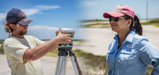
To take in the initial information for her dissertation project, Nguyen is using Terrestrial LiDAR, a laser-based technology, to scan areas likes marshes and tidal flats. The laser pulse takes in tens of millions of data points in less than an hour. With this piece of technology, Nguyen gathers information and her algorithms figure out automatically where the flatlands, water and different types of vegetation are located within the marshes and tidal flats.
“If marshes and tidal flats disappear, we would have a significant problem,” explained Tissot. “The ecosystem would no longer function. For example, where would the shorebirds go or what would happen to the water quality? You have to understand the changes in these areas to figure out what adaptation plans will have the best chance to preserve these critical parts of our coast.”
For those plans, maps and quantitative numbers on a broad scale are needed. The issue arises when the data set is so large that it becomes what many scientists deem “big data”— which is far too much information for a human mind to conceivably process and sort. Nguyen solved this issue by developing algorithms to sort the information. By creating the code, she set the rules for how the program figures out patterns and groups the information in the data.
“It’s great working with the latest technologies in surveying and AI to push research and assist in important planning for our coast,” said Nguyen. “By using the AI algorithm, we can illuminate different aspects of the data that we human beings cannot see.”
For Tissot, working with others on AI projects has always been exciting. Since starting his work with AI at the Island University in 2000, Tissot has participated in several AI related projects, including using it to predict weather patterns to help with cold stunned turtles prepare for flooding and safely navigate Texas waterways. Tissot is presently the Chair of the American Meteorological Society Committee on Artificial Intelligence Applications to Environmental Science and organizing the group’s January conference that will take place in Austin.
“The things I like about AI are the variety of projects, the ability to make good use of the growing data available but also the group of people I’ve worked with in this community,” said Tissot. “It’s really rewarding, interesting and stimulating.”