South Padre Island Beach
NOTE: South Padre Island Beach is currently not being monitored by CBI
Overview:
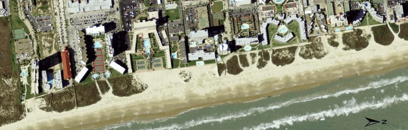
South Padre Island is located in southernmost Texas near the Mexico border. The Brazos Santiago Inlet provides a pathway between the Gulf of Mexico and the Lower Laguna Madre allowing ship traffic to access the Gulf Intracoastal Waterway and Brownsville Ship Channel. The beach to the north of the Brazos Santiago Inlet has a history of erosion that threatens the economy of the Town of South Padre Island and local resident use of the public beach. The Town of South Padre Island began evaluating dune and beach protection and management needs in the early 1990s. A comprehensive study by the Bureau of Economic Geology in 1993 showed that the SPI beach was eroding at a rate of up to 8 ft/yr. Subsequent evaluations and studies by the BEG, Conrad Blucher Institute for Surveying and Science at TAMUCC and the USACE led to the development of a permanent plan for periodic nourishment using channel dredge material was recommended. The beach at South Padre Island has been nourished several times since the first nourishment was conducted in 1997 thorough cooperation of TGLO, USACE and the Town of South Padre Island. CEPRA funding continues to support this long-term nourishment program. CEPRA Cycle 1 provided for beach nourishment at South Padre Island (SPI) which was continued through Cycle 2-4. Nourishment operations continue during 2008 and 2009 with a Cycle 5 award. The Beach Nourishment Project at SPI demonstrated the beneficial use of beach-quality sand dredged (beneficial use of dredge material-BUDM) from Brazos-Santiago Pass during maintenance dredging of the Brownsville Ship Channel by the US Army Corp of Engineers. Nourishment of the beach helped maintain the town’s most important economic asset, the public beach. During Cycle 2, a severely eroding Gulf-facing beach on SPI was nourished using beach-quality sand dredged from Brazos-Santiago Pass. A total of 348,000 cu yd of sand was placed on 3,780 feet of shoreline to complete the Cycle 2 project. South Padre Island beach suffers sand loss due to wind blown transport. A second cycle 2 project nourished 2,000 feet of Gulf-facing beach on the northern portion of the Town of South Padre Island with windblown sand that had regularly covered Park Road 100. A total of 120,000 cu yd of sand was removed from the road by the Texas Department of Transportation (TXDOT) and placed on the beach. During Cycle 4 7,100 cu yd of sand was removed from Park Road 100 and redistributed along the beach fronting the Town of South Padre Island. Originally planned as a BUDM beach nourishment the funds were applied to redistribute the Park Road 100 sand and conduct a sand resources study to identify alternative sources for beach sand. The Cycle 5 project continues removal of sand from Park Road 100 for placement along critically eroding sections of the beach as well as using sand dredged from offshore sources to rebuild dunes and nourish along a 1 mile section of beach.
Location:
View CHRGIS sites in a larger map