North Padre Island Beach (Packery)
Overview:
The North Padre Island barrier island is composed of several beaches located south of Packery Channel. The inlet forms the boundary between North Padre Island and Mustang Island. The beach south of Packery Channel, stretching from the south jetty to Whitecap Blvd., was nourished under CEPRA project 1113. The beach is often referred to as “Packery” by locals and fronts a popular seawall recreational area that was constructed initially during the 1960’s.
Learn More About Packery Channel
The beach fronting the seawall has experienced erosion and shoreline recession for many years prior to the construction of Packery Channel. A component of the Packery Channel project is to utilize dredge material taken from the channel to periodically nourish this beach. The first beach nourishment was completed between 2005/2006 during the construction of Packery Channel. The second beach nourishment was completed during the 2012 dredge event. The third beach nourishment was focused on the south end of the seawall where the narrowest beach is typically observed.
Location:
View CHRGIS sites in a larger map
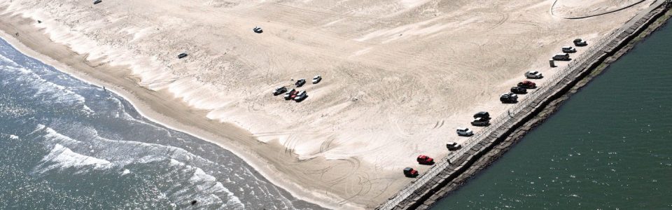
North Padre Island Beach After 2012 Restoration
Photos: Courtesy of Lanmon Aerial Photography Inc.


